Date: 04-08-2017
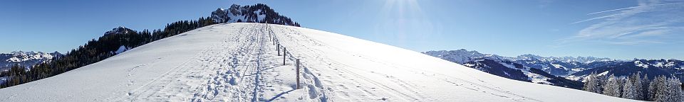
Took a day off to tackle Schimbrig, a summit that was on my todo list for some time. Started somewhat early, as the forecast has announced temperatures in the low 30 degrees. As it turned out to be quite cloudy, it was not that bad in the end. Good parking opportunity can be found just a few meters uphill from the Restaurant Gründli. At first, I wanted to take the path from Hindergrund/Laui to Looegg. However the Farmer at Hindergrund advised me, that the path had almost disappeared and that it would be difficult and exhausting finding the way through the steep forest. He recommended to take the lower path through Chätterech instead, which I did. In Chätterech, the path steepens and about half an hour later you reach the saddle at Ober Looeg. From there, its about another 45 minutes to the summit. The summit was in a cloud most of the time during my activation. This was quite comfortable temperature-wise, but not so good for the view obviously. To return, one can either take the same way back, or alternatively the blue-white marked path going down the east flank of Schimbrig (a good T3 difficulty level). Good hiking boots are advisable as it is quite steep and you have constantly take care of proper footing. This makes it also quite exhausting.
HB/OW-019 Mittaggüpfi/ Gnepfstein and HB/OW-018 Stäfeliflue – 1917/1922m, 6 points
Date: 27-08-2016 ![]()
A nice double-activation that can be done well within one day. Activated together with Clemens HB9EWO. There are convenient parking spaces in the forest just at the foot of the mountain. They seem to fill up rather quick though, as at 08:30 we just managed to get the last free spot (Saturday and good WX). The ascent to the first summit (OW-019 Mittaggüpfi) is well marked and gets gradually steeper. There is one slightly exposed part where a rock wall has to be crossed, followed by a steeper passage where hands might bee needed to get up. Getting to the summit took us about 1h 20 minutes (with a short break in between). The second part follows the ridge first, then descends a bit on the south side of the ridge. Some steep passages follow; chains and wooden steps help a lot passing the more difficult parts. Footing is always good. At the lowest part between the two summits is the Tripolihütte (1763m) where drinks and food is available on sunny weekends. After the hut, the path follows the ridge again, until at Pt.1843 a rock face has to be crossed. Slighty exposed again, but still good footing and chains to get a secure grip. The second part from Mittaggüpfi to Stäfeliflueh took again 1h 20minutes. I was already a bit exhausted and suffered from the heat (it was a very hot day), so this may be done quicker. On Stäfeliflueh we enjoyed the marvellous view, had a snack, and worked the chasers for almost two hours. SOTA at its best! The way down is very steep in the beginning (we were glad not having taken the opposite way round). Again some steep passages secured by chains or ropes, followed by endles zic-zac through the forrest (finally it got cooler), ending up directly at the parking spot again.
HB/SG-054 Schären – 2184m, 8 points
Date: 22-08-2015 09:13-10:57 UTC![]()
The Schären belongs to the Churfirsten group and has only been activated twice before by HB9AFH. It is not so popular among hikers, as there is no marked path up there. I estimate the difficulty a good T3 on the SAC scale. It is mostly a (steep) grass hill, but there are a few rock faces where a way has to be found around them (see photos below). Fortunately, Clemens HB9EWO was with me, he’s an experienced hiker and found a good route around the rocky parts easily. The GPS track is available on sotamaps.org.
Getting there: There’s a quite spectacular cable car (CHF 18.- two way) going up from Starkenbach, saving the first 600m altitude. There’s limited parking available next to the cable car station.
Despite the grass being a bit wet, the soft ground provided good traction, which is important in such steep areas. The view from the top is breathtaking, as on all Churfirsten. Dozens of other SOTA summits can be seen 360 degrees around. On the summit, there’s a small (about 50cm) metal pole holding a case for the summit book. It is very well suited to tie an antenna mast to it. As I left the pole to Clemens, I setup my antenna a few meters below at a stone cairn. I brought a new rig I just finished building, an MTR-5B designed by Steve Weber KD1JV. As expected from a KD1JV rig, it performed flawlessly. Although it offers 5 bands, I could test only 40m and 30m, due to the matching antenna.
HB/GR-121 Regitzer Spitz – 1135m, 2 points
Date: 08-11-2014 09:33-10:06 UTC![]()
The Regitzer Spitz is a fairly easy summit (T2) which can be reached from various directions. I choose to start at the military barracks of St.Luzisteig. Note: The first part of this trail runs through a military training ground / shooting range. If there are exercises held, the trail to Regitzer Spitz will be closed and you’ll have to start your ascent either from St.Luzisteig or Fläsch. This should however never be the case on weekends. The way up is unspectacular, following a wide and easy trail. On the top, there’s a rather large plateau with benches and a long guardrail, offering plenty of antenna building and operating possibilities.
Despite being a nice and mostly sunny day in early November, there was a cold wind on the top, so I was quite a bit frozen after half an hour of operating. The view is however spectacular overlooking the Rhine valley, with many surrounding SOTA summits to be seen.
Continue reading
HB/GL-045 Nüenchamm – 1904m, 6 points
Date: 28-06-2014 10:36-11:23 UTC![]()
For the HB9SOTA diploma, I was missing summits from Kanton Glarus. There are not many in GL that are easy enough to be activated with “basic” hiking skills, but Nüenchamm is probably one of them. There’s a chairlift from Filzbach (CHF 20.- two way), free parking available.
The lower part of the hike was quite soggy, and the whole path is quite uneven with a lot of rocks to step over. This means extra care when it’s wet! The only part that looked a bit challenging (at least from below) was a passage over the last rock face before reaching the final ascent to the summit. It turned out to be rather easy though (not exposed, large rock steps). Nice view from the summit with a lot of neighboring SOTAs in view.
Continue reading
HB/FR-035 La Combe/ La Combert – 1082m, 2 points
Date: 31-05-2014 11:16-11:45 UTC![]()
In order to make progress on the HB9SOTA diploma, I decided to activate a new Canton. Using Google Earth, I found a suitable parking spot for ‘La combe’ (or so I thought…). The first 20 minutes were steeper than anticipated, and I was already a bit exhausted when I stumbled upon another parking space. Bummer… So if you want to save time, consider this alternative parking location. Nothing special on the rest of the hike, although the path was quite soggy and plowed by horse riders. The summit is in the forest and quite unspectacular.
Continue reading
HB/BE-138 Burgfeldstand – 2063m, 8 points
Date: 15-03-2014 09:42-10:23 UTC![]()
The last snowshoe activation this winter, the snow on the way up to the summit was already partly gone. Parked the car in Beatenberg next to the cableway station (CHF 5.- parking fee) and took the cableway up to Niederhorn on 1934m ASL (CHF 19.50 with half-fare pass, CHF 38.- regular).
From the top station, follow the wide road along the ridge in north-eastern direction, slightly downwards until Pt.1918 (I mistakenly climbed up the Niederhorn summit first, which is not necessary). Turn left there and start the ascend to Burgfeldstand (145m up), as indicated on the signpost. It took me exactly 30 minutes to reach the summit from there.
On the summit, the only opportunity to fix an antenna mast is the signpost pole. About 1 meter behind the pole, there’s a sharp drop, so be careful. There was a strong and icy wind, so I didn’t stay too long.
Continue reading
HB/SZ-035 Dossen/Dosse – 1685m, 4 points
Date: 11-01-2014 11:54-13:20 UTC![]()
Easy snowshoe hike. Took the cable way from Kräbel to Rigi-Scheidegg (CHF 22, with half-fare card CHF 11). There’s a big parking lot at the valley station in Kräbel (parking fee). It’s reachable by a small mountain road going up from Goldau. As there was no snow, it was easy to get there, however in deep winter it might be more challenging.
The first part of the hike is downhill, from Scheidegg to Hinder Dosse. From there the final ascent to the summit starts (30min, 140m up).
Continue reading
HB/SZ-028 Hochstuckli – 1566m, 4 points
Date: 03-01-2014 11:18-12:32 UTC![]()
Parked the car in Sattel at the cable way station. Parking is free, as is the charging station for electric vehicles (of which I immediately took advantage). The cable way features revolving gondolas, and brings you up to Mostelberg within 8 minutes (CHF 10 with Halbtax, CHF 20 without).
I took a somehow longer route in order to improve my fitness and to fight the additional pounds gained during the Christmas and New Year season. The route went via Herrenboden, Hals, Spilmettlen, Bannegg to Hochstuckli (see map below). I only mounted the snowshoes from Spilmettlen, when the snow became too deep to walk comfortably. About 400m after Bannegg, the official path enters the forest. There were however not fresh tracks this way. Instead, an existing track lead straight up to the summit, saving the detour the official way would have been otherwise.
Arriving at the summit, I was irritated by a sign that forbids trespassing and threatens a fine up to 500CHF (see image below). I checked the “forbidden area” at home: It is mainly the south-east facing slope of Hochstuckli, leading from the summit to Nätschboden/Haggenegg. The trail I was using to reach the summit runs exactly at the border of this area, so it should be ok when staying at the edge of the forest.
At the summit there’s a nice bench that can also be used as an antenna support. There’s also a wooden summit cross. The activation went smooth, with a lot of stations coming in on 30m.
The way back I chose a more direct route by following mainly the ski lift going from Herrenboden to Hochstuckli.
HB/SZ-027 Stock – 1600m, 4 points
Date: 30-012-2013 10:34-12:53 UTC![]()
Joint activation with Paul HB9DST just before the end of 2013. My first snowshoe tour in this winter season, cold (-5C) but very nice WX. In summer, it is possible to drive up to Tierfäderenegg from where the summit can be reached in less than 30 minutes. In winter however, the upper part of the road to Tierfäderenegg may not be reachable by car, so the best option is to park at Unter-Hirsch, near the small church. There is plenty of parking space there; as it does not look official however, I asked local resident for permission to park, which was kindly granted.
Until the hut at Ober-Stock the snowshoes were not needed, we had to put them on for the last few 100m to the summit only. At the summit, the WX was so nice, we stayed for more than 2 hours and racked up our S2S score.
A nice and easy summit and a good choice to start into the winter season. Many other SOTA summits can be seen from the top (Grosser/kleiner Mythen, Roggenstock, Biet, Grosser/kleiner Aubrig).