Date: 15-06-2013 11:05-12:02 UTC![]()
Access to the parking lot on Fuederegg is only allowed for special permit holders. There’s a public parking opportunity about 2km below, just before the ‘No access’ traffic sign. The way up to the summit is well marked and not too difficult. Nice 360 degree view from the top. Unfortunately my camera slipped out of my pocket on the way up, and I noticed only when I wanted to take some pictures on the top. So I asked a friendly hiker couple that was about to descent to look out for it. They agreed and the gent said, he would give a loud whistle should he discover the camera, and deposit it at a signpost further down the way. Sure enough: While setting up the station a loud whistle sounded from below. Phew, the day was saved. Thanks to the unknown finder! On the summit next to the cross there were thousands of insects, mostly some kind of flying ants. This made operating very uncomfortable at times (especially when they got on the glasses, into the ears,etc). On the descent, I spotted a small marmot family, just emerging from their holes. Cute. A bit later, it started raining, fortunately the parking was already nearby.
Continue reading
Category Archives: Activations
HB/LU-007 Beichle – 1770m, 6 points
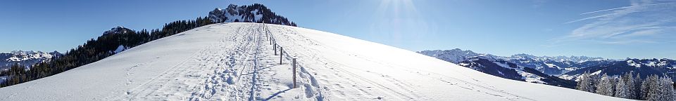
Date: 08-06-2013 11:24-12:16 UTC![]()
Finally a weekend with good WX after a rainy May. There’s a parking opportunity on abt. 1500m altitude, so less than 300m ascent is required on foot. The summit was quite busy due to the good WX, I found a quiet spot a few meters further down tough. I tried 12m on the KX3 and achieved 2 HB9 QSOs (one of them an S2S with HB9BCB/P from HB/BE-159, 40km away, booming in at 599 + 20db).
Continue reading
HB/BL-007 Geissflue – 963m, 1 point
Date: 18-05-2013 12:36-13:18 UTC![]()
First activation in BL, nice weather, Saturday before Whitsunday and a lot of hikers on the way up and down the summit. Big parking lot available. Easy ascent, less than 20 minutes, slightly steep in some parts. There’s a restaurant at the bottom of the hill, open on weekends only though: http://www.schafmatt.ch/
HB/ZH-019 Schneitberg – 671m, 1 point
Date: 11-05-2013 11:21-12:14 UTC![]()
Despite this new Zurich Summit being valid for 11 days only, I was already the 5th activator. The summit is hard to miss, occupied by a big communications tower. The hike up is easy and takes less than 10 minutes.
Continue reading
HB/UR-074 Brandegg – 1108m, 2 points
Date: 09-05-2013 11:16-11:41 UTC![]()
Paul HB9DST notified me about his planned activation of a rare Kanton Uri summit, so I spontaneously decided to join in. Despite the WX forecast not beeing too promising, the actual WX was surprisingly good and we had a lot of sun. Parked at the cable car station in Seelisberg. The hike up was easy, however the summit itself was quite difficult to access as there is no path within the activation zone. So we had to fight our way through the brushwood, which we did only so far to be well within the activation zone.
On this activation I used my new MTR rig (Mountain Top’er, by Steve Weber KD1JV) for the first time. Excellent little rig, wonderfully quiet and sensitive receiver, very small and lightweight. Also as a first, I tested a new half-wave end-fed dipole (EndFedZ 30/40). I forgot to bring the coax that connects the antenna to the rig, fortunately Paul could help me out with a spare one. Phew, thanks Paul! The antenna worked very well, I need however more practice in hanging it up the trees. Paul was already working on a pileup while I was still struggling with the wires.
Continue reading
HB/SZ-032 Chiemen – 601m, 1 point
Date: 13-04-2013 11:57-12:32 UTC![]()
Decided to go for an easy activation in the early afternoon. There’s a paved road right up to the summit, access is however limited to residents only. Parked next to the retirement home ‘Sunnehof’ and walked up to the summit in about 20min. There’s a cell tower right at the top (looks like it’s no longer in service).
Continue reading
HB/AG-011 Würz – 801m, 1 point
Date: 23-03-2013 15:51-15:57 UTC![]()
Today was the annual assembly of the Swiss SOTA Chapter (HB9SOTA). It was great for me to finally meet the persons behind the so well-known call signs and to exchange stories and tips about activations and equipment.
I planned to activate Würz (HB/AG-011) after the assembly, and sure enough, a number of fellow hams decided spontaneously to join in. In the end, a merry group of 5 operators (Hugo HB9AFH, Jürg HB9BIN, Hans HB9BQU, Paul HB9DST and myself) were on the way to the summit. It was only a short stroll from the parking, about 35 minutes, but just right for an mid-afternoon activation. The way up was quite muddy due to the just recently melted snow (you know the feeling when your boots get heavier and heavier due to collecting mud). On the summit, 4 stations were set up, 3 HF and one VHF, covering all bands from 40m to 2m. It was interesting to watch the colleagues in action, and many interesting conversation spun off. Only too soon we packed up and headed down to the car park. All agreed that such joint activations should be organized more often. A great day it was, indeed.
Continue reading
HB/OW-022 Jänzi – 1738m, 4 points
Date: 16-03-2013 15:51-15:57 UTC![]()
Second activation this day after Schlierengrat (HB/OW-021). Although there was a path on the map leading from Schlierengrat down to the valley (Schlierental), it was not visible due to high snow. I hoped to find some tracks from previous hikers, but there were none. So I used the GPS to descend as close to the original path as possible. Walking down the untouched snow surface with snowshoes was a great experience. Once down in the valley, I followed the main trail for about 1km to the south-west, before turning left to the path leading up to Jänzi. I was already quite exhausted from all the hiking, but fortunately the ascent was quite moderate. I reached Jänzi about 16:40 local time, so I had to hurry up (11 QSOs in 6 minutes) to make it back to the parking lot at Langis before dusk.
Continue reading
HB/OW-021 Schlierengrat – 1748m, 4 points
Date: 16-03-2013 12:24-12:54 UTC![]()
Still plenty of snow, so another opportunity for a snowshoe activation. Double activation together with Jänzi, HB/OW-022. Huge parking lot at Langis, however not free (CHF 1/hour). I underestimated the time required for the trip and paid for 5 hours only (it turned out to take 7 hours). Fortunately, there was no parking ticket waiting for me upon return. After the Andresenhütte, a medium steep ascent to the ridge (Schlierengrat) follows. Once on the ridge, the path slightly ascents along the ridge for about 2.5km, up to the final peak of Schlierengrat at 1748m.
Continue reading
HB/SZ-025 Furggelenstock – 1656m, 4 points
Date: 10-03-2013 12:08-13:21 UTC![]()
Maybe the last opportunity this season to activate on snow shoes. Parking at the very top of the Ibergeregg pass requires a fee, there are however also some free parking spaces a few meters down the road. I missed the right path at the beginning, which required me to climb up a rather steep slope to get back to the correct route. See the first picture below for the correct entry point.
The snow was wet and heavy, temperature was about 7C at the parking. The main ascent started right at Ibergeregg up to Brünnelistock (1594m, abt. 150m up) and took me about 30min. From there the path follows the almost flat ridge for about 1.5km, ending in a short but steep ascent to the summit of Furggelenstock.
Continue reading